Posts Tagged ‘Linked Data’

TPDL 2011

Monday, July 11th, 2011, Javier Lacasta

TPDL 2011 will be held next september in Berlin. We will show the following paper:

Transformation of a keyword indexed collection into a semantic repository: applicability to the urban domain. Authors: Javier Lacasta, Javier Nogueras-Iso, Jacques Teller, Gilles Falquet

Abstract:  In the information retrieval context, resource collections are
frequently classified using thesauri. However, the limited semantics
provided by thesauri restricts the collection search and browsing
capabilities. This work focuses on improving these capabilities by
transforming a set of resources indexed according to a thesaurus
into a semantically tagged collection. The core mechanism for
building this collection is based on the conversion of the domain
specific thesaurus (indexing the collection of resources) into a
domain ontology connected to an upper level ontology. The
feasibility of this work has been tested in the urban domain by
transforming the resources accessible through the European Urban
Knowledge Network into a Linked Data repository.

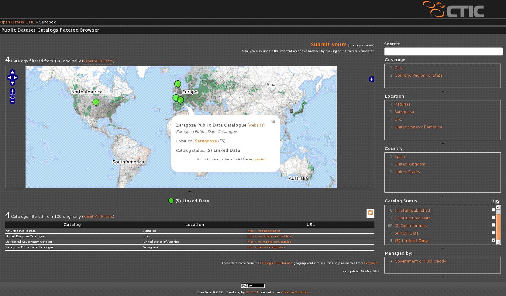
zaragoza.es Una Web de 5 estrellas

Monday, May 23rd, 2011, Fco. Javier Zarazaga-Soria

En los días previos a la celebración del Bilbao Web Summit (http://www.bilbaowebsummit.com, 17 y 18 de mayo) se llevo a cabo la reunión del Comité Asesor del W3C en esta misma ciudad (15 y 16 de mayo).
En este evento, el director del W3C, Tim Berners-Lee, reconoció públicamente los logros conseguidos por la Web del Ayuntamiento de Zaragoza en materia de datos abiertos. Procediendo a entregar al equipo técnico de la Web una taza conmemorativa de tal reconocimiento.

Taza 5 estrellas

Según Berners-Lee, la Web municipal se encuentra en el nivel de las 5 estrellas (http://inkdroid.org/journal/2010/06/04/the-5-stars-of-open-linked-data/). Este nivel solamente ha sido conseguido por otras 3 instituciones públicas en el mundo: el Gobierno de Estados Unidos, el Gobierno del Reino Unido, y el Principado de Asturias.

Web 5 Estrellas

El trabajo de apertura de datos comenzó de la mano de la Infraestructura de Datos Espaciales del Ayuntamiento de Zaragoza (IDEZar: http://idezar.zaragoza.es), extendiéndose después a otras áreas de contenidos de la institución. Para ello, entre otros, ha contado durante estos últimos 7 años con el equipo del IAAA y GeoSpatiumLab (http://www.geoslab.com)

Defensa de la tesis doctoral de Francisco J. López-Pellicer

Friday, April 8th, 2011, Fco. Javier Zarazaga-Soria

Hoy ha defendido su tesis Francisco J. López-Pellicer.

Con el título de “Semantic Linkage of the Invisible Geospatial Web”,la tesis ha sido dirigida por los doctores Rubén Béjar y F.Javier Zarazaga-Soria.
Este trabajo presenta un recorrido de investigación que lleva desde el descubrimiento de servicios Web geo-espaciales, a su exposición a la Web visible mediante Linked Data.
Dentro de unos días la tesis estará disponble para su descarga. Mientras tanto es posible acceder a un resumen/abstract de la misma.

Semantic Linkage of the Invisible Geospatial Web

DEXA 2010 and EGOVIS 2010

Monday, June 7th, 2010, Francisco J Lopez-Pellicer

DEXA’10 and EGOVIS’10 will be held in conjunction next September. We present two papers.

  • Francisco J. Lopez-Pellicer, Mário J. Silva, Marcirio Chaves, F. Javier Zarazaga-Soria and Pedro R. Muro-Medrano, Geo Linked Data
  • Miguel Ángel Latre, Francisco J. Lopez-Pellicer, Javier Nogueras-Iso, Rubén Béjar, and Pedro R. Muro-Medrano, Facilitating E-government Services through SDIs, an Application for Water Abstractions Authorizations

We present in DEXA 2.010 the paper Geo Linked Data. This paper research a feasible approach for using maps as data in Semantic Web applications.  If the maps were machine-processable, it is possible to avoid messages such as “We are sorry, but we don’t have imagery at this zoom level for this region”, or select the most appropriate map to present data. Our contribution involves (1) the characterization of geospatial proxies, geospatial Web resources that could complement Semantic Web descriptions about entites, (2) the identification of their roles in semantic applications, (3) a recipe based on Linked Data practices for publishing alongside geospatial Web resources and RDF descriptions, and (4) best practices for advertising the presence, role and location of geospatial proxies.

We present to EGOVIS 2.010 the paper Facilitating E-government Services through SDIs, an Application for Water Abstractions Authorizations. In the last years, there has been a huge increment in the number of e-government services offered to the citizens and companies. However, environment-related permits are among the least developed kind of e-government services in Europe. Environmental management and government requires the use of geographic information and SDIs are being providing the framework for optimizing its management, and they are becoming a legal obligation for some countries and institutions. In order to make profit of geographic information technologies and of the obligation of building SDIs to contribute to the development of e-gov services, we presents how to use SDIs (for example IDE Ebro) in a real tool in the area of the environment-related permits: the application for a water abstraction authorization. SDI services are used for the capture, management, and assess of geographical information in a full transactional level e-government service.

Publishing Open Goverment Data

Friday, May 21st, 2010, Francisco J Lopez-Pellicer

I’ve have just re-read the W3C Working Draft Publising Open Government Data. It’s abstract is compelling:

Every day, governments and government agencies publish more data on the Internet. Sharing this data enables greater transparency; delivers more efficient public services; and encourages greater public and commercial use and re-use of government information.

Publish and sharing implies clients that access and integrate data. In the Geo world this is enabled by Spatial Data Infrastructure (SDI):

There is a clear need, at all scales, to be able to access, integrate and use spatial data from disparate sources in guiding decision making. Our ability then, to make sound decisions collectively at the local, regional, and global levels, is dependent on the implementation of SDI that provides for compatibility across jurisdictions that promotes data access and use (Douglas Nebert, The SDI Cookbook).

However, the approach behind the W3C draft is quite straighforward:

  • Publish the data in its raw form (XML, RDF, CSV). Formats that allow data to be seen but not extracted are not useful for this approach.
  • Create an online catalog of the raw data (complete with documentation) so people can discover what has been posted.
  • Make the data both human- and machine-readable. That is, use XHTML, RDFa, content negotiation, “cool uris”…

The intended purpose of this approach is allow third parties to create and develop new interfaces to the data that may not be obvious (even absurd) to the data providers. The publication of the data should be separated from the interfaces, enabling mashup developers, data integrators, data crawlers … access to the raw data.

AGILE 2010

Friday, May 21st, 2010, Francisco J Lopez-Pellicer

We present on AGILE 2010 two full papers:

  • Francisco J. Lopez-Pellicer, Aneta J. Florczyk, Javier Nogueras-Iso, Pedro R. Muro-Medrano and F. Javier Zarazaga-Soria – Exposing CSW Catalogues as Linked Data
  • Aneta J. Florczyk, Francisco J. Lopez-Pellicer, Rubén Béjar, Javier Nogueras-Iso and F.Javier Zarazaga-Soria – Applying Semantic Linkage in the Geospatial Web

Both papers represent our current view-point on how the Geospatial Semantic Web could be developed on top of current Spatial Data Infrastructures.

Francisco J. Lopez-Pellicer will present Exposing CSW Catalogues as Linked Data. This work explores the idea of “linked” CSW cataloges as a solution to ease the findability of geospatial metadata on the Web. This paper presents a toolkit that exposes as Linked Data the content of CSW metadata repositiories. The work developed by Aneta J. Florczyk, Applying Semantic Linkage in the Geospatial Web, explores how the semantic links to resources with spatial content can be applied to improve the recall of queries in metadata repositories.

It seems that Linking data is a hot topic in AGILE 2010. For example Sven Schade and Simon Cox presents a promising paper: Linked Data in SDI or How GML is not about Trees